Tuesday, 28 June 2011
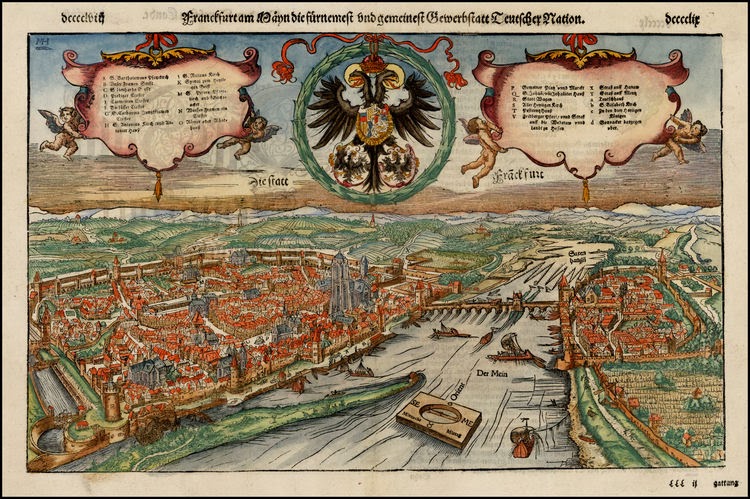
Frankfurt (1544)
View of Frankfurt am Main, from Sebastian Munster's Cosmographia, first published in 1544.
The view is centered on the Main River, with a bridge between. Munster's Geographia (first published in 1540) and his later Cosmographia were cartographic landmarks. The Geographia included not only Ptolemaic maps, but also a number of landmark modern maps, including the first separate maps of the 4 continents, the first map of England and the earliest obtainable map of Scandinavia. The Cosmographia (first published in 1544) was the earliest German description of the world and a major work in the revival of geographic thought in 16th-century Europe. Altogether, about 40 editions of the Cosmographia appeared between 1544 and 1628.
Munster dominated cartographic publication during the mid-16th Century. Munster is generally regarded as one of the important map makers of the 16th Century. Munster was a linguist and mathematician, who initially taught Hebrew in Heidelberg. He issued his first mapping of Germany in 1529, after which he issued a call geographical information about Germany to scholars throughout the country. The response was better than hoped for, and included substantial foreign material, which supplied him with up to date, if not necessarily accurate maps for the issuance of his Geographia in 1540.
Subscribe to:
Post Comments (Atom)


No comments:
Post a Comment
Note: only a member of this blog may post a comment.